
Head up 19E in Tennessee and catch some Trout and a few Memories

There are so many opportunities to find wild brook trout and some stocked rainbow in the Blue Ridge Mountains (Appalachian Mountains) in Carter County Tennessee. A fly fisherman could spend a year or more discovering tiny creeks in pursuit of trout. In this blog, I will share some of the streams, flies used, recommended fly shops, places to stay, camping areas and fly fishing gear (Tenkara and Western Fly Fishing)
The waters will be described with fly fishing in mind.

NOTE!!!! This Picture was from my old website. It does NOT exist anymore.
Doe River
Hampton Creek
Little Doe River
Tiger Creek
Laurel Fork
Little Stoney Creek
Doe Creek
Stoney Creek
The typical waters fished for trout in Carter County are Watauga Lake and Watauga River. And YES, these waters are productive and Big trout are caught often. However, if the TVA is generating, drift boat guides, rafting companies are running; it makes fly fishing (wading) nearly impossible. That one of the reasons I chose to fish the smaller waters.Another reason is the creeks are predictable and loaded with fish. These creeks and small rivers are freestone, which helps them clear up quickly after heavy rains (it rains plenty out here). Also, “ a rule of thumb” is any year round creek that is above 2500 ft above sea level more than likely has wild Brook trout. Rainbows are typically stocked in the larger streams.
The fish a wild for the most part, which is an advantage for the stealth fisherman. These fish will strike at nearly any fly present in front of them, as long as it imitates something that occurs in the area.
Doe River
There are 2 sections of the Doe River that have good populations of fish; Middle and Upper.
Middle Section
Bear Cage Road to Roan Mountain
Access- This section of Doe River has plenty of access points with plenty of pull outs and fisherman’s trail. Pressure can be heavy on Holidays and after stocking from the TWRA. There are places posted of Private Property
Flows- Being a freestone river it can get blown out during heavy rains. Head to the upper section when this area is flowing fast.
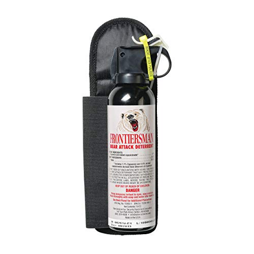
Camping- There are numerous places to camp along the Old Railroad Grade Rd and also on the fisherman’s trail. BEWARE!!!!! Lots of Bears in the area!!! Carry Bear Spray.
Upper Doe Creek
From the Town of Roan Mountain to Roan Mountain State Park
Access- This section of the Doe River is known as the Upper Doe. Because of its proximity to the State Park there can be heavy fishing pressure. As for access, there are plenty of places to get in the water. In addition, there are plenty of places to park. Churches line the road and typically allow you to park on their property on non service days. Best places to find Rainbows is in the picnic areas. For wild Browns, Brooks and Rainbows go above the campgrounds.
Flows- fairly consistent unless either it has rain heavily or Not rained for a week or so. Go to the upper part to find clearer water. This is a freestone river so pay attention to the weather forecasts.
Camping- is restricted to established campsites.

Hampton Creek
Hampton Creek has once again 2 sections the Lower and Upper. Best times of year to fish are from November-Late March.

Lower Section- This area is stocked occasionally and fished out quickly.
There is a little bit more water in this part of the creek. Giving more fishing spots.
Rainbow trout are the normal catch.
Access- Tough because of so much private property. There are a couple of places to “Bridge Hop”.
But, be warned locals are not afraid to confront you if they feel you are trespassing. Very little parking
Flows- skinny water with a few pools during the summer months. Also, plenty of garbage in the creek.
Upper Hampton Creek (Cove) above the waterfall- 1.0 miles


This part of the creek is much more challenging but well worth the effort. The hike is up hill the whole way. Once you get to the Fish Dam (Waterfall) there is plenty of signage explaining the special regulations. Brook trout are the only species of trout to be in the area. Watch the video down below for my personal take on the regulations.
Access- Because this section is public property it is also very easy to get into the creek in plenty of spots. Pressure is very minimal because of the location and no stocking.
Flows- The water gets extremely low during the summer months. Plenty of pocket waters and a few runs. Shaded nearly the entire section.


Little Doe River
I discovered this water by accident. What I thought was the Doe River was actually a small tributary that flows for miles until converging down stream in Hampton Tn. Though it is stocked about 1 time a year it has plenty of wild hold over Rainbows. The tree canopy can get thick during the summer, shorter fly rods work best.
Access- Fairly easy to find a place to fish. Best place to start is behind the Dollar General and work up stream. There is private property up and down the water but owners are good with allowing access.
Flow- This area surprisingly has great water flow year round. It can get muddy when rain has been heavy. It has a small feeder creek (Tiger Creek) that brings in cool water.
Tiger Creek
A very small creek that feeds into the Little Doe River. Often overlooked and hardly anyone fishes giving minimal pressure on the Trout. Rainbows, Browns and some Brooks are always hungry for a nymph.
Access- Tough…. Private property is everywhere. Ask someone if you can fish their property. Normally they will always say yes.
Flows- Cool springs give a year round supply of perfect trout waters. During heavy rains it can get a little muddy.
Laurel Fork
Just outside of Hampton this creek can be very productive. There are 3 Sections that have good populations of Trout.
Lower section (Laurel Falls to Doe River)
Even though parts of this run through the Hampton it gets little attention. Large Brown Trout are often landed as they move their way up the Doe River to either spawn or get out of the way of flood waters.
Access- Remarkably easy. There are a few places with private property signs posted, but for the part getting into the water is a breeze.
Flows- During heavy rain this section gets blown out. When this happens go to the higher sections.
Middle section Dennis Cove (From the campground down to the waterfalls)
Stocked heavily during the season and gets plenty of action. It is a pleasantly slow stream. Up near the campground there is pocket water and a few long runs. Below the campground the stream slows and gets deep. Both Brown and Rainbow Trout are plentiful.
Access- Very good. Parking on the other hand can get horrible. Because this an area the AT (Appalachian Trail) crosses there are plenty of people doing day hikes.
Flows- Plenty of water year round. in The heat of the summer try to fish under the tree canopy and in deep water. Also, pocket water is a good source of Oxygen for the fish.
Upper Level (FROG LEVEL)
Because of its remote location many people fore go the trek. That is great if you are search of wild trout. Brown Trout in the 17 inch range are common to be caught. The creek meanders through meadows and forest. You are in the heart of The Bear Sanctuary! Plus Copperheads and Ticks are everywhere.
I HIGHLY SUGGEST BEAR SPRAY AND A FIRST AIDE KIT
Access- very remote. Nearly everywhere is Public Lands. There are a few camping areas that are consider dispersed and no water. There are times I fished and did not see a person for 14 hours.
Flows- water tends to stay cool and clear year round. best place on Laurel Fork if it has been raining for a few days.
Little Stoney Creek
A very small pocket water creek that flows into Watauga Lake. Other than the local Trout Unlimited chapter few others fish this water. It has a very good population of wild Brook Trout.
Access- There is a stretch of private property right after you get on the road. However, locals are more than happy to give you access. Higher up you are in the National Forest and you’ll have plenty of water to fish.
Flows- Can get skinny during the heat of the summer. However, there are some deep pocket waters that hold fish.
Doe Creek
This creek has a special place in my fishing memory. Landing 82 trout in a day it has been my personal best day of fish caught. One of the only spring creeks in the area Doe Creek stays clear and cool constantly. Pressure is fairly low because people have a tendency to drive right by. There are 2 sections that hold different types of fish.

Lower Section (Dollar General Store to Watauga Lake)- can be a great place to hook up on large Rainbow Trout during the spawning season. Plenty of long runs, shade and deep pools. A few River Otters live in the pools which like to snatch fish being caught. But there are plenty of fish to go around. Right at the inlet section holds a large population of Small Mouth Bass also.
Access- a few places to pull over. Very steep and overgrown at times to get to the water be careful. Pressure can be heavy during the summer as people are playing in the creek.
Flows- During heavy rain this section gets blown out. It can take a day or more before fishing gets back to normal.
Upper Section (Old Stage Road to Pleasant’s Store)- Loaded with medium sized Rainbows and some Brook Trout. Water is always cool due to springs. This section has plenty of undercut banks, shade, ripples and a few runs. The grade of the creek is fairly level in this area.
Access- Easy… nearly the entire section is not fenced or posted with private property signs. Park near the bridges. If someone does approach you, just explain to them that you are fishing. Usually, they’ll ask “how’s the fishing” and continue on with their day.
Flows- Perfect nearly all year long. Even during heavy rains this creek will still be fishing well.
Stoney Creek
“Stoney” as the locals call it, is one of the trickier creeks to fish in Carter County. Access can be tough and the creek gets murky quick after rains. On top of that it has an enormous amount of trash in it. Now for the great news… not only is Stoney Creek stocked very heavily but it empties into the Watauga River. Trophy size Browns are common in this area. This is not a secret spot and everyone fishes this area. Upper Stoney as a strong population of Wild Rainbows.
Access- I mentioned hard access, Yes it is. However, most land owners in this area understand the water right-away. If you tell them you bridge hopped in the creek and are just fishing nearly all the time they will actually tell you where the “secret holes” are. Parking is fair. If you are going to fish the section from the Volunteer Fire Station down creek best place to park is at the Fire Station.
Flows- Being the largest creek flowing into the Watauga River from the North end of the valley this water gets big. When rain has occurred up the valley it can take a few days for Stoney to clear up.
Recommended Gear
Links to Fly Shops
Maps of the area
Places to Stay